Kodiak Island (aka: “the emerald isle”) is the largest island in Alaska and is the second largest island in the United States. It is 252 air miles south of Anchorage (a 45-minute flight). The Kodiak National Wildlife Refuge encompasses nearly 1.9 million acres on Kodiak and nearby Afognak Island. Kodiak Island has been inhabited for the past 8,000 years.
Fisheries are a very prominent part of the local economy. For many years, Kodiak was ranked as one of the busiest seafood ports in Alaska and the region. In 2001, fisheries landings were valued at $74.4 million, ranking third among all United States ports. Government also plays a major economic role in the Borough, with the presence of the U.S. Coast Guard Station and the Kodiak Launch Complex. Other government projects include the Kodiak Fisheries Research Center and the University of Alaska’s Fishery Industrial Technology Center.
Visit the Kodiak Island Convention & Visitor’s Bureau online


Akhiok
Akhiok is a second class city in the Kodiak Island Borough. Akhiok is located at the southern end of Kodiak Island at Alitak Bay. It lies 80 miles southwest of the City of Kodiak and 340 miles southwest of Anchorage.
Residents of nearby Kaguyak relocated to Akhiok after the 1964 earthquake and tsunami destroyed their village. The city was incorporated in 1972.
Photo Credit: DCCED; Div. of Community and Regional Affairs’ Community Photo Library
Afognak
Afognak is an unincorporated area in the Kodiak Island Borough. This traditional Alutiiq (Russian-Aleut) village was located on Afognak Bay, on the southwest coast of Afognak Island, north of Kodiak Island.
The Good Friday Earthquake of 1964 generated a tsunami that destroyed the village. A new community was constructed on the northeast coast of Kodiak Island, called Port Lions, and the residents of Afognak moved there permanently in December 1964.

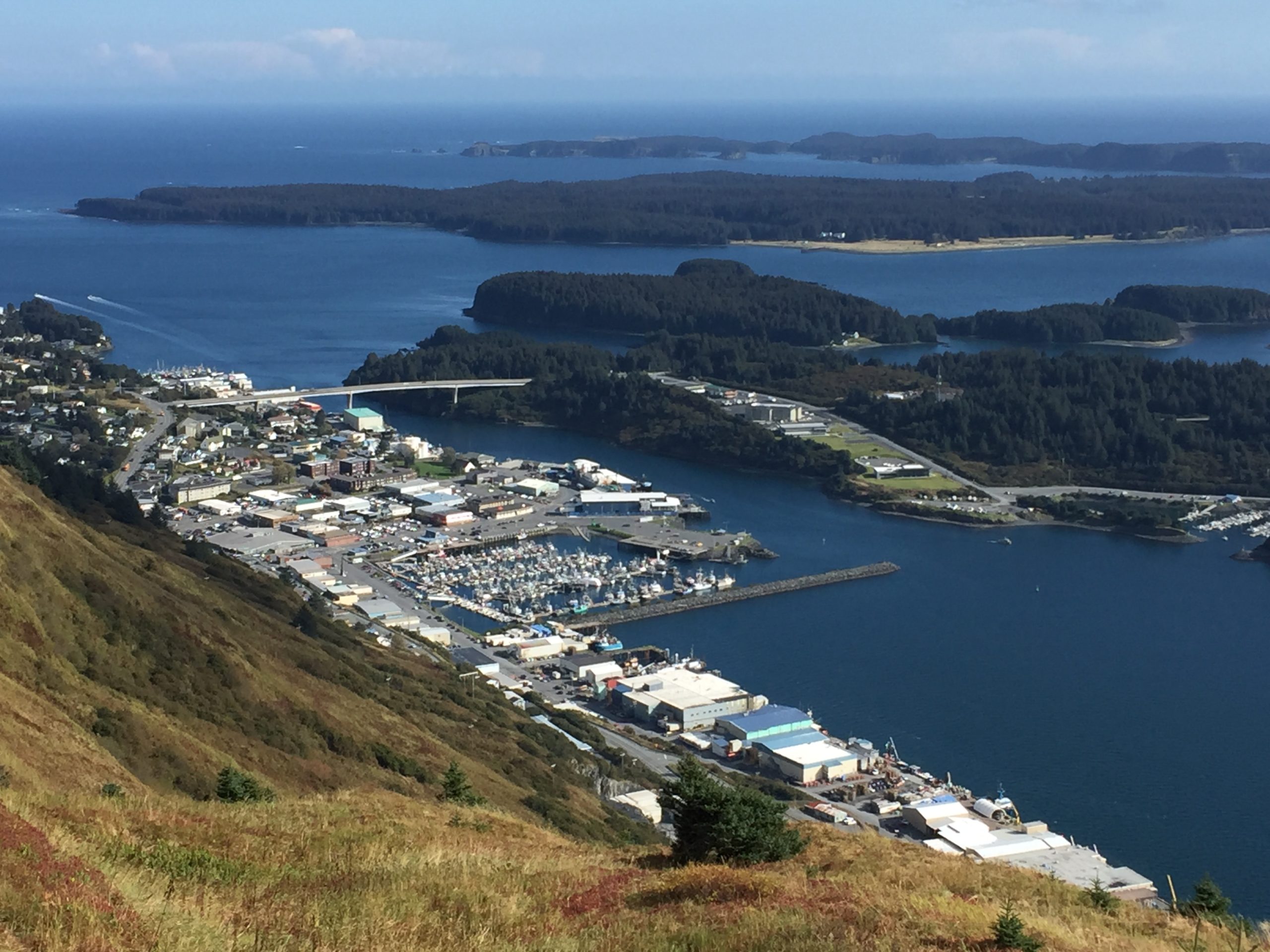
Kodiak
Kodiak is a Home Rule City in the Kodiak Island Borough, located near the northwestern tip of the island. The City of Kodiak was incorporated in 1940. During the Aleutian Campaign of World War II, the U.S. Navy and U.S. Army built bases on the island. Fort Abercrombie was constructed in 1939 and later became the first secret radar installation in Alaska. The 1964 earthquake and subsequent tidal wave virtually leveled downtown Kodiak. Infrastructure was rebuilt, and, by 1968, Kodiak had become the largest fishing port in the country in terms of dollar value. The Magnusson Act in 1976 extended the U.S. jurisdiction of marine resources to 200 miles offshore, which reduced competition from the foreign fleet and, over time, allowed Kodiak to develop a groundfish processing industry.
Karluk
Karluk is an unincorporated area in the Kodiak Island Borough. Karluk is located on the west coast of Kodiak Island, on the Karluk River, 88 air miles southwest of Kodiak and 301 miles southwest of Anchorage. By 1900, Karluk was known for having the largest cannery and the greatest salmon stream in the world.
After a severe storm in January 1978, the village council decided to relocate the community to the present site, upstream on the south side of the lagoon. HUD constructed 23 houses at the new community location.


Larsen Bay
Larsen Bay is a second class city in the Kodiak Island. The community of Larsen Bay is located on Larsen Bay, on the northwest coast of Kodiak Island. It is 60 miles southwest of the City of Kodiak and 283 miles southwest of Anchorage. The area is thought to have been inhabited for at least 2,000 years. The economy of Larsen Bay is primarily based on fishing.
Photo Credit: DCCED; Div. of Community and Regional Affairs’ Community Photo Library
Ouzinkie
Ouzinkie is a second class city in the Kodiak Island Borough. Ouzinkie is located on the west coast of Spruce Island, adjacent to Kodiak Island. It lies northwest of the City of Kodiak and 247 air miles southwest of Anchorage.
Ouzinkie started as a retirement community for the Russian American Company. In 1964, the Good Friday Earthquake and resulting tsunami destroyed the Ouzinkie Packing Company cannery.


Old Harbor
Old Harbor is a second class city in the Kodiak Island Borough. Old Harbor is located on the southeast coast of Kodiak Island, 70 miles southwest of the City of Kodiak and 322 miles southwest of Anchorage.
The area around Old Harbor is thought to have been inhabited for nearly 2,000 years. In 1964, the Good Friday Earthquake and resulting tsunami destroyed the community; only two homes and the church remained standing. The community was rebuilt in the same location. The city government was incorporated in 1966.
Port Lions
Port Lions is a second-class city within the Kodiak Island Borough. It is located near the mouth of Kizhuyak Bay on the north end of Kodiak Island.
The Good Friday Earthquake of 1964 caused a tsunami which nearly destroyed the Village of Afognak on Afognak Island, north of Kodiak Island. In the wake of the destruction, the displaced inhabitants of Afognak established Port Lions in 1966. It is named in honor of the Lions Club, for their support in rebuilding and relocating the village.
